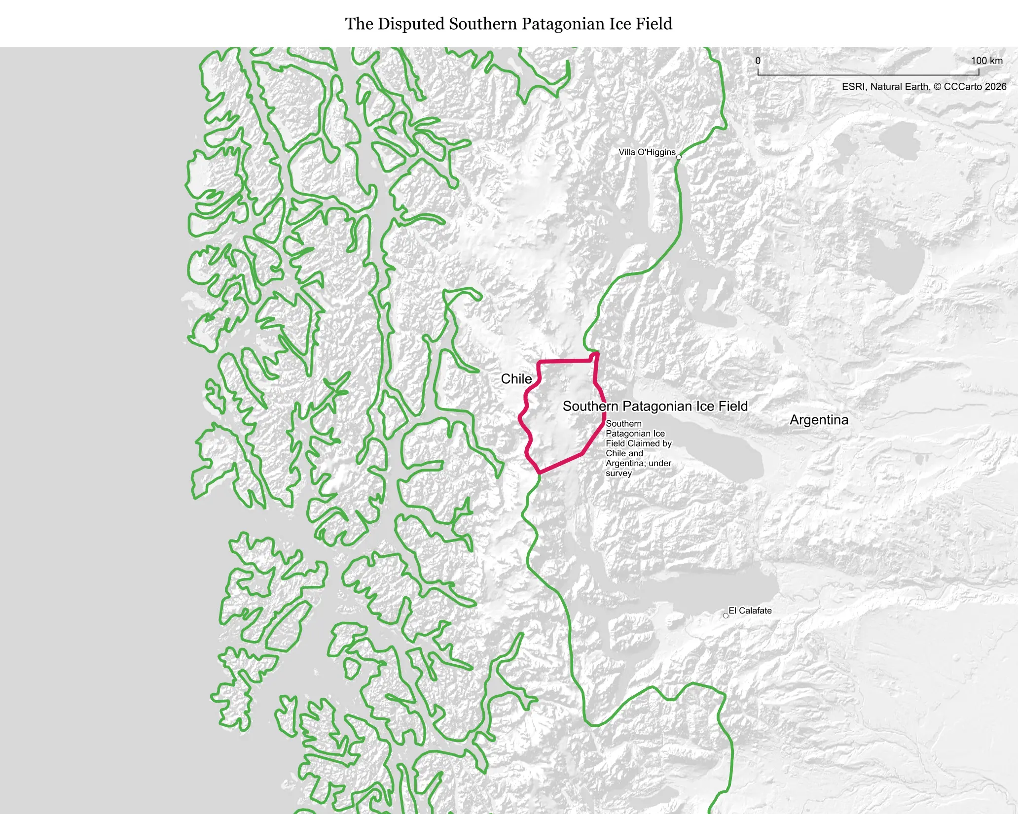
What makes this territory disputed
The Southern Patagonian Ice Field straddles the Chile-Argentina border, and while most of that long boundary was settled through an 1881 treaty and subsequent arbitrations, including a 1902 British-mediated ruling and a 1994 arbitration over the nearby Laguna del Desierto area, a roughly 50-kilometer stretch running directly through the ice field itself has never been precisely demarcated. The difficulty lies largely in the terrain: surveying a fixed line across constantly shifting glacial ice has proven far harder than marking a border across solid ground.
Who is involved, and for how long
The dispute is between Chile and Argentina and forms part of a much broader, mostly resolved history of Patagonian boundary disputes stretching back to the late 19th century. Most of the surrounding border was addressed by a 1998 framework agreement between the two countries, but the specific ice-field segment near peaks like Cerro Murallón and Monte Fitz Roy has remained technically open for decades since, without either side pressing hard for a final resolution.
Resources and strategic value
The ice field itself holds enormous volumes of fresh water, making it scientifically valuable for glaciology and climate research as one of the largest non-polar ice masses on Earth, alongside meltwater that feeds hydroelectric potential downstream. Its main practical draw today is tourism, particularly around the nearby and far more famous Perito Moreno Glacier, rather than any contested economic resource within the disputed strip itself.
Who lives there and what's on the land today
Essentially no one lives on the ice field itself; it is used only by scientific research expeditions studying glacial retreat and by mountaineers attempting some of Patagonia's most technically demanding peaks. There is no permanent settlement, infrastructure, or economic activity within the specific disputed segment.
Is the boundary stable?
Yes, in practice, despite the formal legal ambiguity. Both countries have observed a de facto hands-off approach to the unmarked segment for decades, and the 1998 framework agreement addressing most of the surrounding area effectively normalized the situation even though the final short stretch through the ice remains technically pending.
Is a resolution coming?
There is no urgency on either side. Joint Chile-Argentina boundary commissions periodically revisit the outstanding segment as a technical matter, but given the area's total lack of population, resources, or strategic stakes, neither government treats it as a pressing diplomatic priority, and it may simply remain unresolved indefinitely without causing any practical problems.
Does this dispute affect the world?
Barely, and that is precisely what makes it notable: it stands out as one of the very few genuinely peaceful, low-stakes border disputes anywhere, of interest mainly to glaciologists tracking ice loss in a rapidly warming climate and to mountaineers rather than to policymakers or global markets.
Sources
- Government of Chile, Dirección Nacional de Fronteras y Límites del Estado (DIFROL): DIFROL — Chile boundary information
- Wikipedia: Southern Patagonian Ice Field
- Britannica: Patagonia