What makes this territory disputed
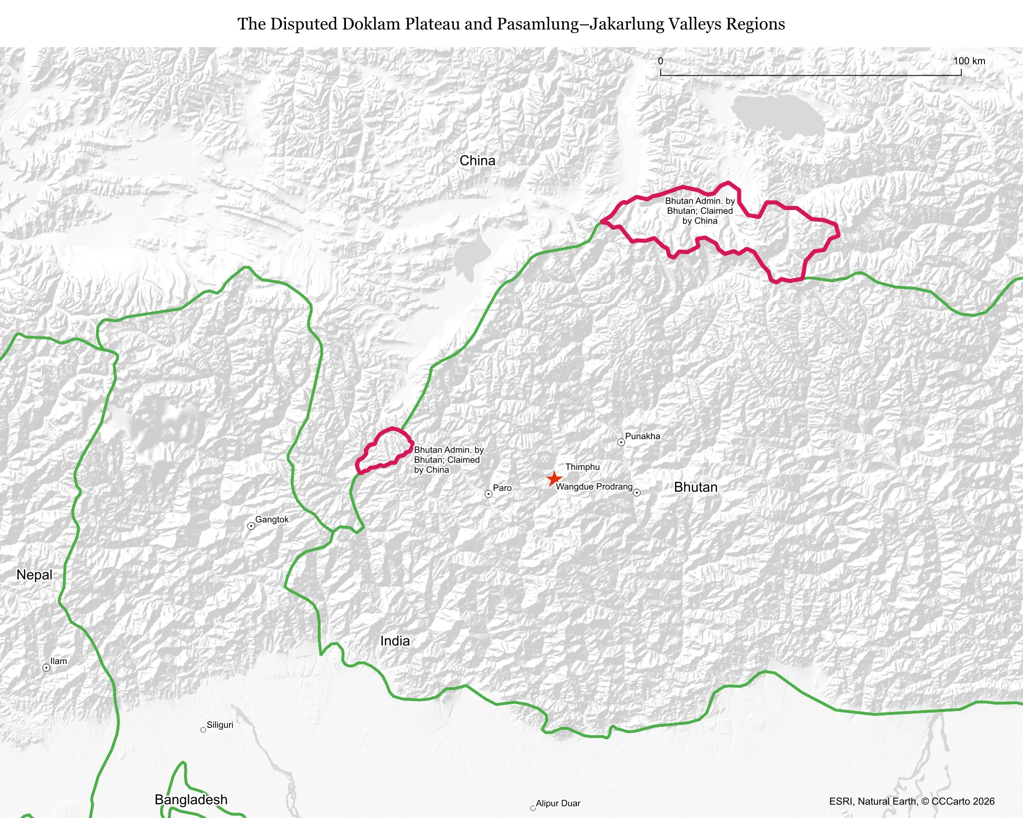
Doklam, along with the nearby Pasamlung and Jakarlung areas, is claimed by both China and Bhutan, a small Himalayan kingdom with no formal boundary agreement with China. The dispute stems from colonial-era ambiguity over where the boundary between Tibet and Bhutan actually runs, but it gained global attention because of its proximity to India, which treats any Chinese advance there as a direct security threat.
Who is involved, and for how long
The formal dispute is between China and Bhutan, but India is deeply involved as Bhutan's security guarantor under a bilateral friendship treaty. Bhutan and China have held boundary negotiations since 1984 without resolving the area's status, and the dispute became an acute international crisis in 2017 when Chinese road-building construction prompted a 73-day military standoff involving Indian, Chinese, and Bhutanese forces.
Resources and strategic value
Doklam itself has little economic value; its importance is purely strategic. The plateau overlooks India's Siliguri Corridor, a strip of land as narrow as roughly 20 kilometers wide in places that is the only land connection between mainland India and its northeastern states, making any Chinese military presence nearby a serious concern for Indian defense planners.
Who lives there and what's on the land today
The area is essentially uninhabited except for seasonal use by Bhutanese herders grazing yaks at high altitude. Since the 2017 standoff, satellite imagery has documented significant Chinese construction in and around the disputed zone, including new villages, roads, and military infrastructure built in territory Bhutan considers its own or disputed.
Is the boundary stable?
No. Despite the 2017 standoff ending in a mutual troop withdrawal, China has continued incremental construction in the wider area in the years since, a pattern often described as 'salami-slicing' territorial gains without triggering another full-scale confrontation. This makes the situation more accurately described as tense and shifting than genuinely settled.
Is a resolution coming?
Possibly, but slowly. Bhutan and China signed a memorandum of understanding in 2021 outlining a three-step roadmap toward a boundary settlement and have continued talks since, marking unusually direct diplomatic engagement for Bhutan, which has no formal diplomatic relations with China. India's strategic interest in the outcome, however, complicates any purely bilateral Bhutan-China deal.
Does this dispute affect the world?
Yes, disproportionately to its size. Doklam is widely viewed as one of the more plausible flashpoints for direct India-China military conflict given the stakes for India's northeastern connectivity, and the 2017 standoff was one of the most serious India-China confrontations in decades, drawing global attention to the risk of escalation between two nuclear-armed neighbors.
Sources
- Council on Foreign Relations: China-India Border Dispute — Global Conflict Tracker
- Reuters: Reuters — Asia Pacific
- International Crisis Group: Asia-Pacific overview
- Observer Research Foundation: ORF — analysis on Doklam and Bhutan-China talks