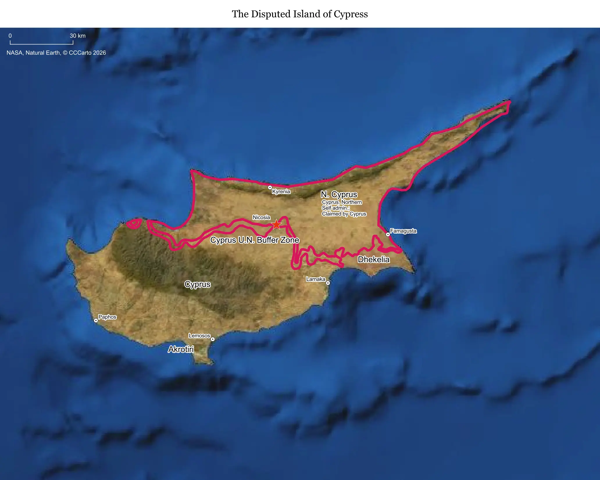
What makes this territory disputed
Cyprus has been split since 1974 between the internationally recognized Republic of Cyprus in the south and the Turkish-administered north, which declared itself the Turkish Republic of Northern Cyprus in 1983. The division followed a Greek Cypriot coup aimed at uniting the island with Greece, which prompted a Turkish military invasion to protect the Turkish Cypriot minority after years of earlier intercommunal violence going back to 1963.
Who is involved, and for how long
The dispute is primarily between Greek Cypriots and Turkish Cypriots, with Greece and Turkey as heavily invested outside guarantors under a 1960 treaty framework. The division has now lasted more than 50 years, making it one of the world's longest-running unresolved partitions, patrolled continuously by the UN peacekeeping force UNFICYP since 1964.
Resources and strategic value
Beyond tourism and Cyprus's strategic position in the Eastern Mediterranean, the discovery of substantial offshore natural gas fields since the 2010s has added a sharp new economic dimension, with the Republic of Cyprus and Turkey disputing exploration rights in overlapping maritime zones. The island's location also makes it militarily significant, hosting British sovereign base areas left over from colonial rule.
Who lives there and what's on the land today
Roughly 900,000 people live in the Republic of Cyprus in the south, while the north has a population of around 380,000, which includes a substantial number of settlers from mainland Turkey in addition to Turkish Cypriots. Nicosia remains the world's last divided capital city, split by the UN-patrolled Green Line buffer zone that runs through the heart of the old town.
Is the boundary stable?
Yes, essentially frozen. The ceasefire line established in 1974 has not meaningfully moved in five decades, monitored continuously by UNFICYP, though crossing points have opened over the years and periodic tensions flare over gas exploration rights offshore rather than over the land boundary itself.
Is a resolution coming?
Not in the near term. The most serious recent reunification effort, the Crans-Montana talks in 2017, collapsed without agreement, and Turkish Cypriot leadership has since shifted toward advocating a permanent two-state arrangement rather than the federal reunification model the UN has pursued for decades, a position Greek Cypriots and most of the international community reject.
Does this dispute affect the world?
Yes, in several ways. It is a persistent obstacle to Turkey's EU accession process, since Cyprus is a full EU member and has blocked negotiating chapters; it also intersects with Eastern Mediterranean energy geopolitics as gas discoveries raise the stakes of unresolved maritime boundaries between Cyprus, Turkey, Greece, and Israel.
Sources
- United Nations Peacekeeping: UNFICYP — UN Peacekeeping Force in Cyprus
- European Council on Foreign Relations: Cyprus and EU-Turkey relations
- International Crisis Group: Cyprus
- CIA World Factbook: Cyprus