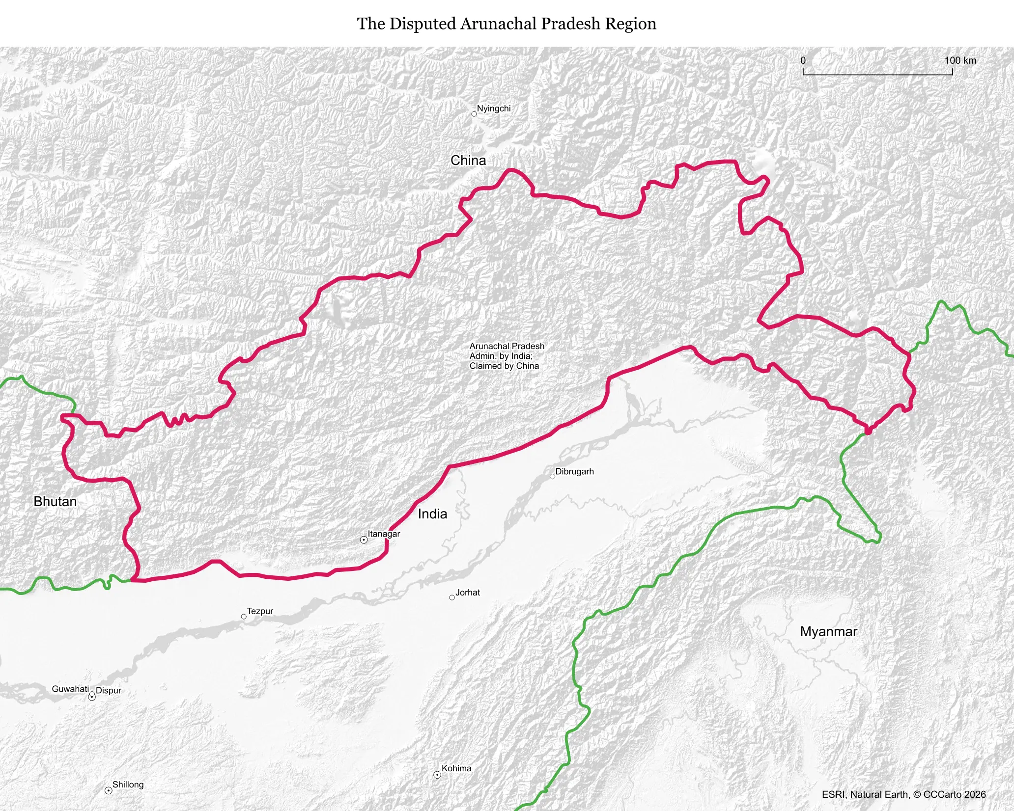
What makes this territory disputed
Arunachal Pradesh is a fully functioning Indian state that China claims in its entirety as part of Tibet, referring to it in official communications as 'South Tibet.' The disagreement centers on the 1914 McMahon Line, drawn between British India and Tibet at the Simla Convention, which China has never recognized on the grounds that Tibet lacked the sovereign authority to agree to it.
Who is involved, and for how long
The dispute is bilateral, between India and China, and it has been active since the 1950s as both countries consolidated control over the Himalayan frontier after India's independence and the Chinese Communist Party's takeover of Tibet. It escalated into open war in 1962, when Chinese forces advanced into the region before withdrawing, and low-level friction has continued for more than six decades since.
Resources and strategic value
The state holds major hydropower potential from rivers including the Brahmaputra (known as the Yarlung Tsangpo in Tibet), along with dense forests, rich biodiversity, and strategically vital high-altitude terrain overlooking key Himalayan approaches. China's large dam-building program upstream on the same river system has become a growing concern in India over future water flows into Arunachal Pradesh and beyond.
Who lives there and what's on the land today
Arunachal Pradesh has a population of roughly 1.5 million, including many distinct tribal communities, and the Tawang region in particular has deep Tibetan Buddhist cultural and religious ties, home to one of the largest Buddhist monasteries outside Tibet itself. India fully administers the state with roads, schools, an elected legislature, and a growing military and civilian infrastructure buildup along the border.
Is the boundary stable?
The India-China frontier here, part of the broader Line of Actual Control, is not formally demarcated and has seen periodic friction, including a December 2022 clash between Indian and Chinese troops near Yangtse in the Tawang sector. While no territory has changed hands in this specific state in recent years, the absence of an agreed border means localized standoffs can recur without warning.
Is a resolution coming?
Not in the foreseeable future. More than 20 rounds of Special Representative-level talks since 2003 have failed to produce a boundary settlement, and China continues to reassert its claim symbolically, including by publishing renamed place lists for locations inside Arunachal Pradesh as recently as the 2020s, a practice India firmly rejects.
Does this dispute affect the world?
Yes. Both countries are nuclear-armed and among the world's largest militaries, so any serious escalation here carries outsized global risk. The dispute also feeds into wider Indo-Pacific dynamics, including India's deepening security ties with the US, Japan, and Australia through groupings like the Quad, partly as a hedge against Chinese assertiveness along this frontier.
Sources
- Ministry of External Affairs, India: India-China boundary question
- Council on Foreign Relations: China-India Border Dispute — Global Conflict Tracker
- International Crisis Group: China
- Reuters coverage of the Yangtse clash: Reuters — India