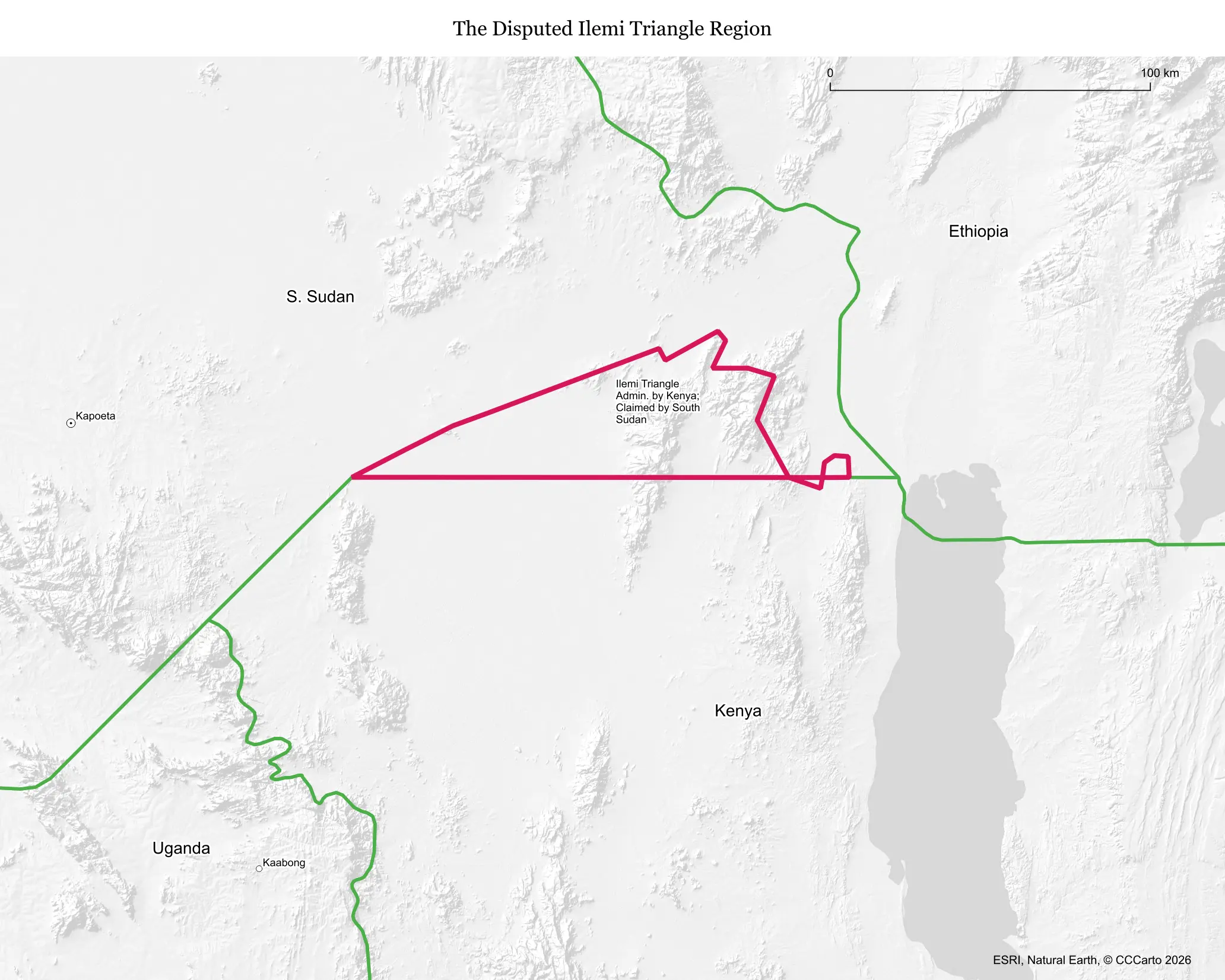
What makes this territory disputed
The Ilemi Triangle is a remote, arid stretch of land whose status was left unresolved by a series of inconsistent British colonial boundary agreements drawn in 1907, 1914, and 1938. Those overlapping lines never produced an agreed final border between what were then British administrations, and the ambiguity passed down first to independent Kenya and Sudan, and later to South Sudan after its 2011 independence.
Who is involved, and for how long
The dispute is mainly between Kenya and South Sudan, which inherited Sudan's historical claim, with Ethiopia's border also touching the area's edges. It has remained unresolved since the colonial boundaries were drawn in the early twentieth century, making it one of Africa's oldest continuously ambiguous border zones, albeit one that has rarely produced serious state-level conflict.
Resources and strategic value
The triangle's primary value is as grazing land, essential to the seasonal migrations of Turkana pastoralists from Kenya and Toposa pastoralists from South Sudan, who depend on its pastures and water sources for their cattle herds. Some oil exploration interest has emerged in the wider region in recent years, though the Ilemi area itself remains largely undeveloped.
Who lives there and what's on the land today
The population is sparse and largely nomadic, with Turkana and Toposa communities moving through seasonally rather than maintaining large permanent settlements. Kenya maintains a light but consistent administrative and security presence, effectively controlling the territory in practice even without a final legal settlement.
Is the boundary stable?
Yes, in the sense that the lines have not formally shifted in decades, though the area sees recurring low-level violence, mostly communal clashes over grazing rights, water access, and cattle raiding between Turkana and Toposa groups rather than conflict between the Kenyan and South Sudanese governments themselves.
Is a resolution coming?
Not actively. There is no serious bilateral negotiation underway, and South Sudan's own severe internal instability since its 2011 independence has left it with little bandwidth to press a formal claim, meaning Kenya's de facto control is likely to continue indefinitely without a final legal resolution.
Does this dispute affect the world?
Its global significance is minimal today, though it has real regional humanitarian stakes tied to pastoralist conflict, cross-border displacement, and periodic communal violence. Future oil exploration in the wider area could raise its profile, but for now it remains one of the world's more obscure and low-intensity territorial disputes.
Sources
- CIA World Factbook: Kenya
- CIA World Factbook: South Sudan
- International Crisis Group: Horn of Africa