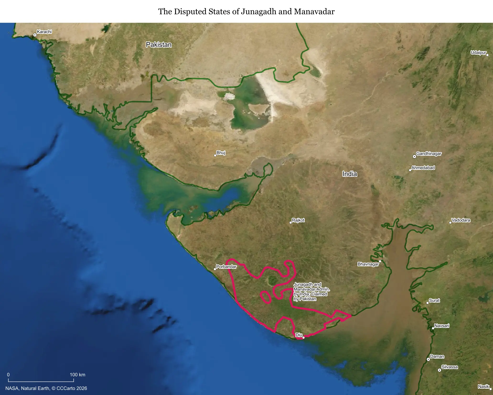
What makes this territory disputed
Junagadh and the smaller neighboring state of Manavadar were princely states in what is now Gujarat, ruled at independence by Muslim nawabs presiding over Hindu-majority populations. When British India was partitioned in 1947, Junagadh's ruler chose to accede to Pakistan despite the state having no land connection to it and sitting entirely inside what became Indian territory, a decision India refused to accept.
Who is involved, and for how long
The dispute is nominally between India and Pakistan, dating to the 1947-48 partition period, but it was effectively settled on the ground within a year. India sent troops into Junagadh in late 1947 after the nawab fled to Pakistan, then organized a plebiscite in February 1948 in which the population voted overwhelmingly to join India, a result Pakistan has never formally accepted even though it never contested it militarily again.
Resources and strategic value
Junagadh today is a developed district of Gujarat, home to the Gir Forest, the world's only wild refuge for Asiatic lions, along with productive agricultural land and the coastal port town of Veraval, historically important for fishing and trade. It has no significant contested resources or strategic military value in practice, since India's control has never been in question operationally.
Who lives there and what's on the land today
Around 2.5 million people live in the area today, fully integrated into Indian Gujarat with ordinary infrastructure, schools, and governance. There is no ambiguity in daily life, administration, or security, unlike genuinely active disputes elsewhere on this list.
Is the boundary stable?
Completely stable and has been since 1948. This is one of the most settled entries on any list of 'disputed' territories, since the only thing that remains disputed is Pakistan's official cartographic depiction rather than any actual contested control or population uncertainty.
Is a resolution coming?
It is, in practice, already resolved on the ground, though Pakistan is unlikely to formally drop its symbolic claim because doing so would undercut the logic it uses in the ongoing Kashmir dispute, where it argues that the will of a state's population, not just its ruler's decision, should determine accession.
Does this dispute affect the world?
Minimally today. Its main significance is illustrative: it shows how the same 1947 principle, that a princely ruler's choice of accession is not necessarily final, cuts in different directions depending on which country invokes it, a dynamic that remains highly relevant to the unresolved and far more consequential Kashmir dispute.
Sources
- Encyclopaedia Britannica: India — Partition and Princely States
- Government of Gujarat: Junagadh district information
- Wikipedia: Junagadh State