

Rhode Island State Maps | Complete Map Collection
Rhode Island State Maps: Detailed Maps for Counties, Cities, Federal Areas, Physiographic & Ecoregions
Welcome to our comprehensive collection of Rhode Island State Maps, meticulously curated to provide detailed, high-resolution visualizations of the state’s geography, political boundaries, and natural regions. These maps are designed for students, researchers, planners, and anyone seeking an in-depth visual reference.
- Counties and Cities: Clearly defined county boundaries and major cities for planning, education, and demographic reference.
- Federal Areas: National parks, forests, monuments, wildlife refuges, military installations, and other federally managed lands.
- Physiographic Regions: Major landforms and terrain features such as mountains, plains, valleys, plateaus, and coastal areas.
- Ecoregions: Ecological zones representing forests, grasslands, deserts, wetlands, and other biodiversity regions.
Map Profile
- Format: JPEG
- Color: RGB
- Resolution: ~72 DPI
- Typical image size: ~1300 × 1700 px
- Paper size: Letter (8.5 × 11 inches)
- Layouts: Portrait and Landscape
- File size: ~100–500 KB
Print tip: In your print dialog select Letter (8.5×11), choose Portrait or Landscape, and use Fit to Page (or Scale - to fit).
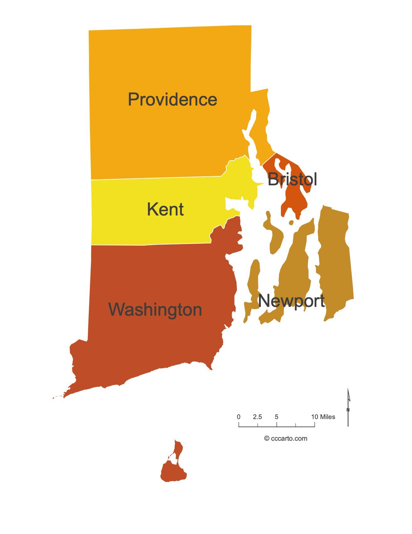
Rhode Island Counties Interesting Facts
Rhode Island has 5 counties (no county govts). Providence dominates; the coastlines of Newport and Washington bring bays and beaches.
- Number of counties: 5 — RI.gov
- First & last established: First counties 1703; last created Kent (1750) — Newberry Atlas
- Highest & lowest county: Highest Jerimoth Hill in Providence County; lowest sea level in coastal counties (e.g., Newport) — USGS
- Most & least populated: Most: Providence; Least: Bristol
- Least & most developed: Most: Providence; Least: Bristol
- Most geographically diverse: Washington County (ocean beaches, salt ponds, uplands)
- Strangest-shaped county: Newport County — a patchwork of islands and peninsulas
- State’s Biggest Commodity: Greenhouse, nursery, floriculture & sod. USDA Ag Census (RI profile).
- State’s Biggest Employer (private): Lifespan. About Lifespan.
- Top 3 Languages (besides English): Spanish, Portuguese, French. Census/ACS (DataUSA).
About CCCarto – Rhode Island State Maps Creator
CCCarto has been producing professional digital and GIS maps for large companies, government agencies, and educational institutions since 1988. With over 35 years of cartographic experience, our Rhode Island state maps are designed to the highest standards of accuracy, clarity, and usability.
Our map collection spans counties, cities, federal lands, ecoregions, physiographic regions, topographic relief, and more — giving students, researchers, educators, planners, and curious explorers the best Rhode Island state map resources available online. Every map is optimized for both screen viewing and letter-size printing.
Explore our full U.S. State Maps collection, or browse our Geology Maps, Travel Maps, and Energy Maps.
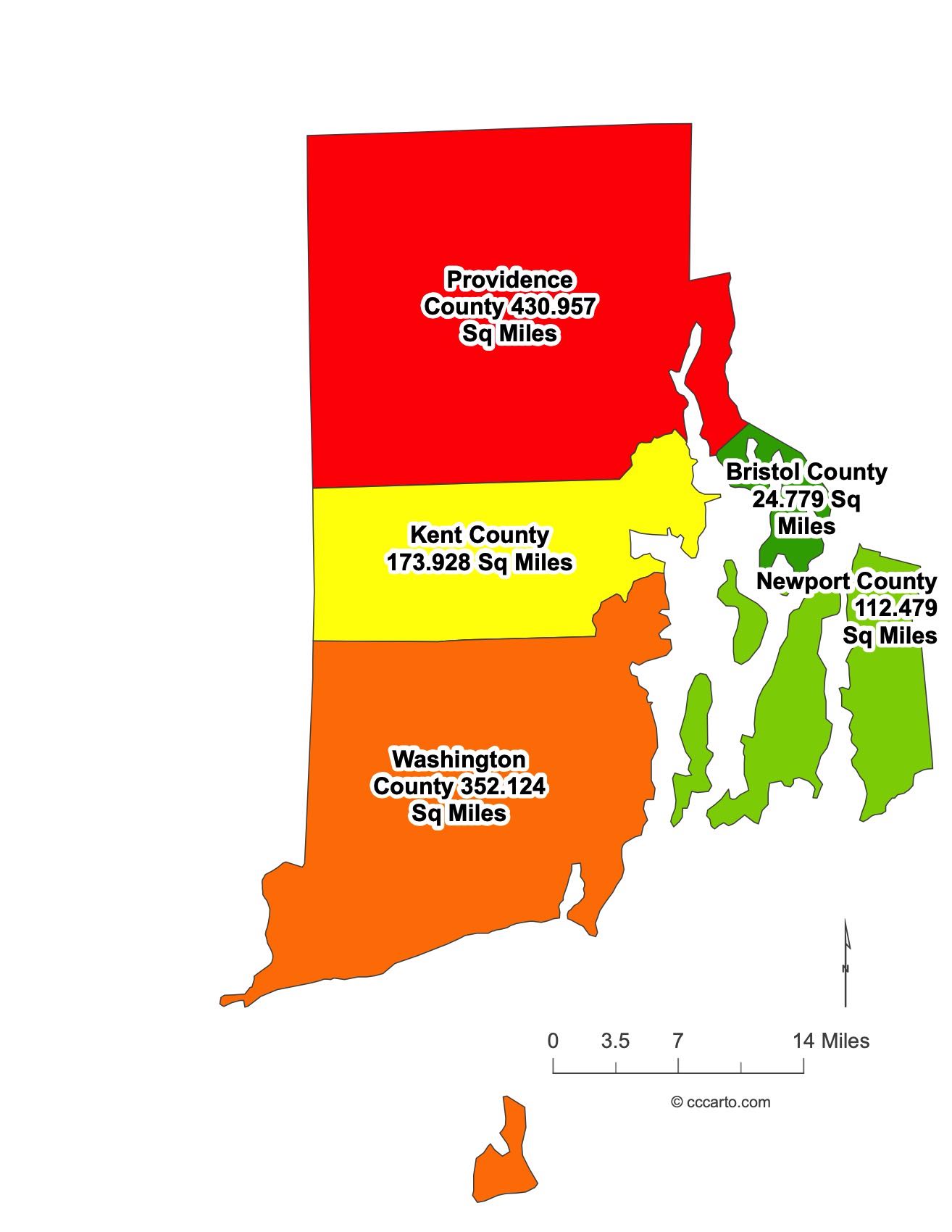
Rhode Island County Sizes State Map
Smallest County in Rhode Island State
Bristol County: 25 sq miles
Largest County in Rhode Island State
Providence County: 431 sq miles
Mean and Median Area of Counties in Rhode Island State
Mean Area: 170 sq miles
Median Area: 274 sq miles
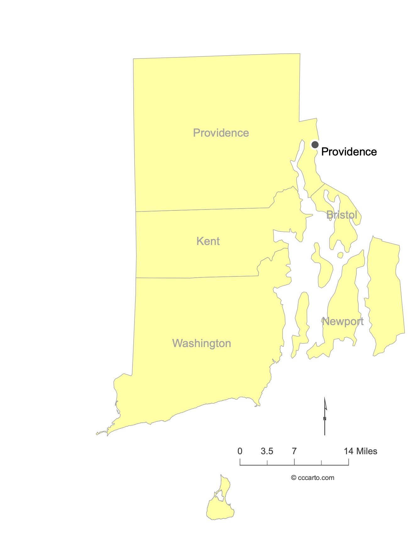
Major Cities of Rhode Island | Rhode Island Cities State Map
In Rhode Island, major cities are concentrated near the coast and serve as historical ports. Below are examples of significant cities:
1. Providence
Providence: The largest city and the capital of Rhode Island, it is known for its historic waterfront, colonial history, and vibrant cultural scene.
2. Newport
Newport: Famous for its Gilded Age mansions and its strategic coastal location, Newport has been a key port and cultural hub for centuries.
3. Warwick
Warwick: Known for its historic role in the American Revolution and its location along Narragansett Bay, Warwick is an important economic and transport hub.
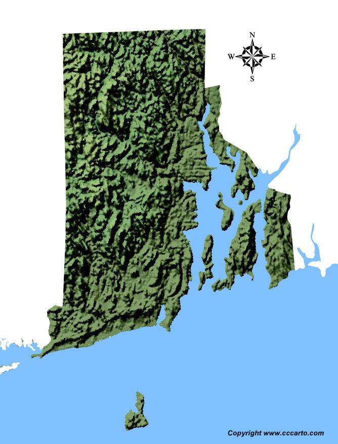
Rhode Island Topographic State Map | Shaded Relief
Rhode Island State, despite its small size, offers diverse topography ranging from coastal plains to small rolling hills. Explore the Coastal Plains and New England Uplands for a tour of Rhode Island’s varied landscapes.
1. Coastal Plain
The Coastal Plain of Rhode Island is characterized by sandy shores, salt marshes, and estuaries, with many towns relying on fishing and maritime trade. This region includes much of Narragansett Bay.
2. New England Upland
This region covers the inland parts of Rhode Island with rolling hills and forested areas. The land is fertile and has been used for agriculture, especially in earlier centuries. Today, it is known for its scenic views and historic farmsteads.
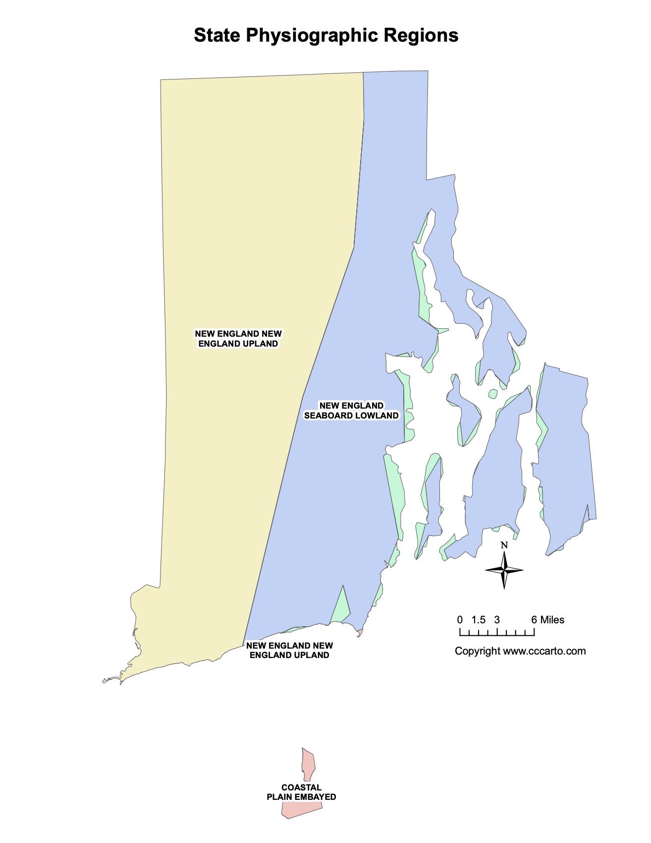
Rhode Island Physiographic Regions State Map
Coastal Plain, Embayed
The Coastal Plain, Embayed region covers the flat and sandy areas along the coast, including Rhode Island's famous beaches and marshes.
New England Upland
The New England Upland is characterized by hilly terrain and has a diverse ecology, with mixed hardwood forests. It covers inland Rhode Island and contributes to the state’s rural charm.
New England Seaboard Lowland
The New England Seaboard Lowland region includes areas around Narragansett Bay, providing rich soils and low-lying land ideal for settlements and agriculture.
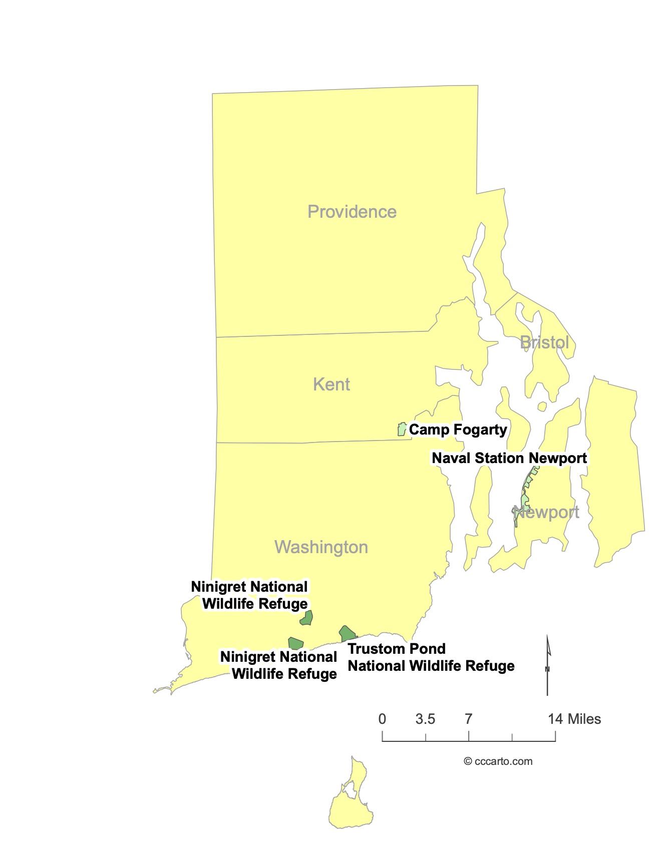
Rhode Island Federal Lands State Map | National Parks & Protected Areas
1. Roger Williams National Memorial
This park commemorates the life and legacy of Roger Williams, the founder of Rhode Island. It offers a peaceful green space in the heart of Providence and historical exhibits.
2. Ninigret National Wildlife Refuge
Ninigret provides opportunities for wildlife observation, hiking, and photography. It’s one of the state’s largest coastal habitats, known for its salt marshes and birdlife.
3. Blackstone River Valley National Historical Park
This park tells the story of the early American industrial revolution, with sites along the Blackstone River. It preserves important historical landscapes and offers trails for recreation.