

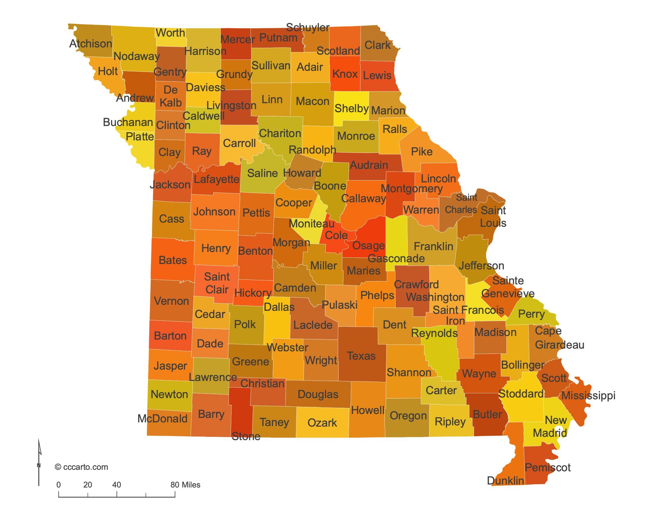
Missouri State Maps | Complete Map Collection
Missouri State Maps: Detailed Maps for Counties, Cities, Federal Areas, Physiographic & Ecoregions
Welcome to our comprehensive collection of Missouri State Maps, meticulously curated to provide detailed, high-resolution visualizations of the state’s geography, political boundaries, and natural regions. These maps are designed for students, researchers, planners, and anyone seeking an in-depth visual reference.
- Counties and Cities: Clearly defined county boundaries and major cities for planning, education, and demographic reference.
- Federal Areas: National parks, forests, monuments, wildlife refuges, military installations, and other federally managed lands.
- Physiographic Regions: Major landforms and terrain features such as mountains, plains, valleys, plateaus, and coastal areas.
- Ecoregions: Ecological zones representing forests, grasslands, deserts, wetlands, and other biodiversity regions.
Map Profile
- Format: JPEG
- Color: RGB
- Resolution: ~72 DPI
- Typical image size: ~1300 × 1700 px
- Paper size: Letter (8.5 × 11 inches)
- Layouts: Portrait and Landscape
- File size: ~100–500 KB
Print tip: In your print dialog select Letter (8.5×11), choose Portrait or Landscape, and use Fit to Page (or Scale - to fit).
Missouri Counties Interesting Facts
Missouri has 114 counties + St. Louis (independent city); St. Louis County & Jackson lead totals.
- Number of counties: 114 + 1 independent city — List
- First & last established: Early MO Territory; last Worth (1861) — Newberry Atlas
- Highest & lowest county: Highest at Taum Sauk (Iron); lowest in Bootheel (Dunklin) — USGS
- Most & least populated: Most: St. Louis County; Least: Worth
- Least & most developed (proxy): Most: St. Louis County; Least: Worth (links above)
- Most geographically diverse: Taney County (Ozark plateaus & lakes)
- Strangest-shaped county: Pemiscot County (notched Bootheel)
- State’s Biggest Commodity: Soybeans. USDA ERS
- Largest Private Employer: Walmart (statewide). State list
- Top 3 Non-English Languages: Spanish, Chinese, Vietnamese — DataUSA
About CCCarto – Missouri State Maps Creator
CCCarto has been producing professional digital and GIS maps for large companies, government agencies, and educational institutions since 1988. With over 35 years of cartographic experience, our Missouri state maps are designed to the highest standards of accuracy, clarity, and usability.
Our map collection spans counties, cities, federal lands, ecoregions, physiographic regions, topographic relief, and more — giving students, researchers, educators, planners, and curious explorers the best Missouri state map resources available online. Every map is optimized for both screen viewing and letter-size printing.
Explore our full U.S. State Maps collection, or browse our Geology Maps, Travel Maps, and Energy Maps.
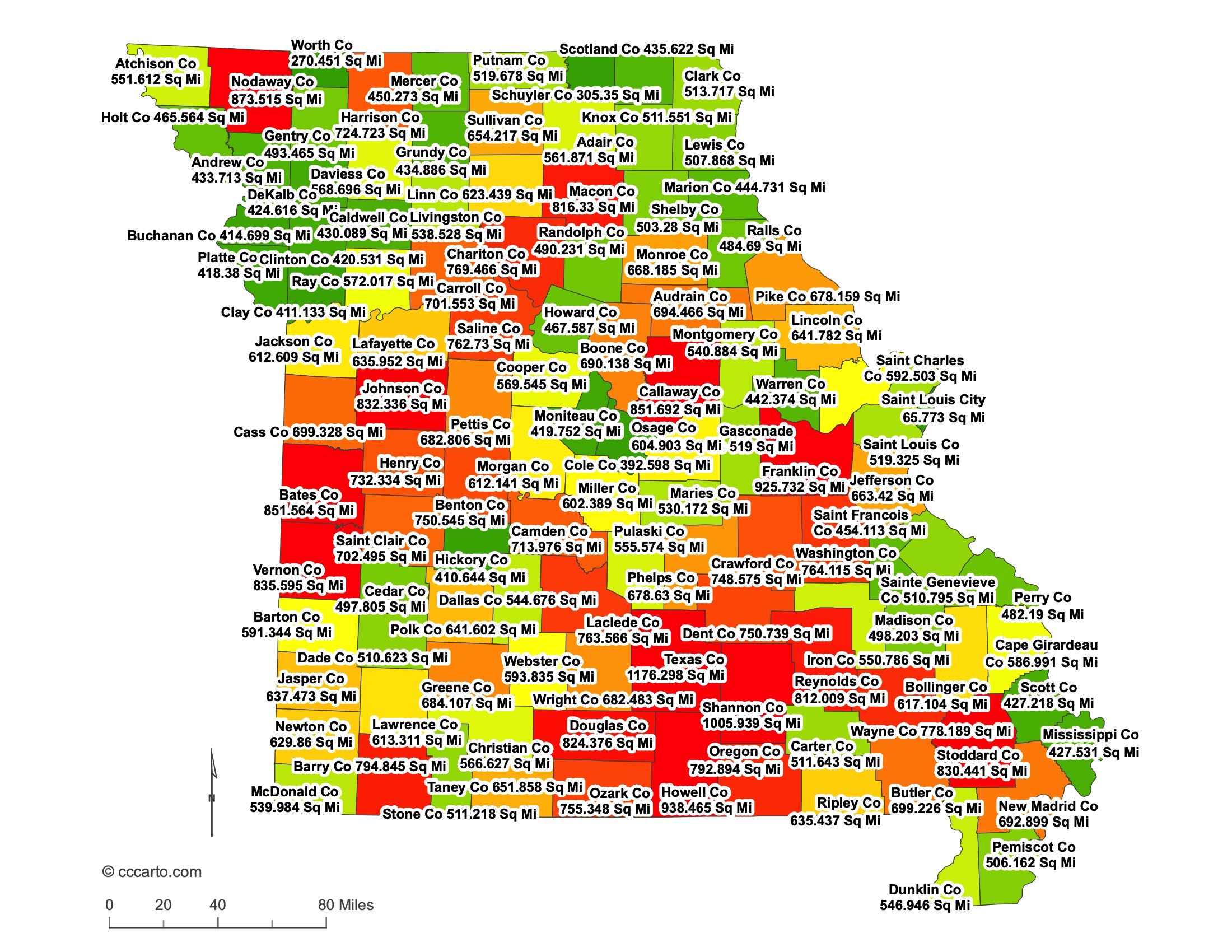
Missouri County Sizes State Map
Smallest County in Missouri State
Worth County: 270 sq miles
Largest County in Missouri State
Texas County: 1,176 sq miles
Mean and Median Area of Counties in Missouri State
Mean Area: 594.5 sq miles
Median Area: 539 sq miles
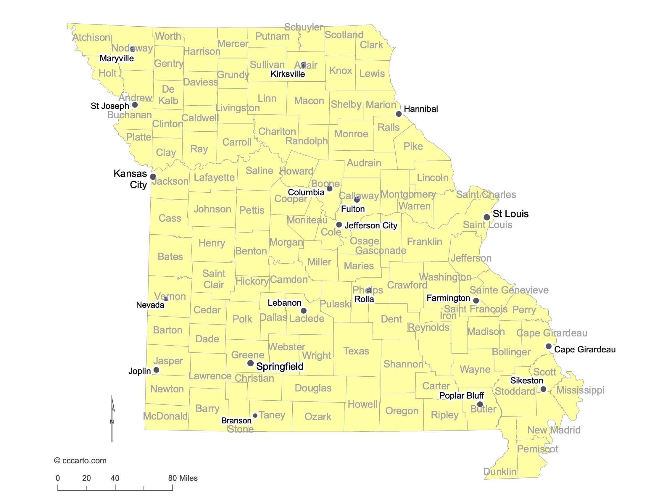
Major Cities of Missouri | Missouri Cities State Map
In Missouri State, most major cities are strategically located along rivers or transportation routes. Below are examples:
1. River Cities
St. Louis: Located on the Mississippi River, St. Louis has historically been a major trade center and is known for its iconic Gateway Arch.
Kansas City: Situated on the Missouri River, Kansas City is a major hub for agriculture and industry.
St. Joseph: Located along the Missouri River, St. Joseph played a significant role in westward expansion as the starting point of the Pony Express.
Joplin: Located in the southwestern corner of Missouri, Joplin was historically a key mining town and is now a commercial hub for the region.
Hannibal: Situated on the Mississippi River, Hannibal is famously known as the boyhood home of author Mark Twain and is rich in historical significance.
2. Historic Paths or Routes
Springfield: Known as the "Queen City of the Ozarks," Springfield is located along historic transportation routes and is an important cultural center in southern Missouri.
Branson: Known for its entertainment industry, Branson is located in the Ozarks and attracts millions of visitors annually with its theaters, music venues, and outdoor recreation.
Kirksville: Located in northern Missouri, Kirksville is home to Truman State University and a regional hub for education and healthcare.
Lebanon: Located along the historic Route 66, Lebanon is a key city in central Missouri known for its role in agriculture and manufacturing.
Farmington: Located in southeastern Missouri, Farmington serves as a regional center for commerce and is known for its proximity to state parks and outdoor activities.
Rolla: Known for its engineering university, Missouri University of Science and Technology, Rolla is strategically located along Interstate 44 and plays a key role in education and research.
Poplar Bluff: Located near the Black River in southeastern Missouri, Poplar Bluff serves as a regional center for commerce, healthcare, and transportation.
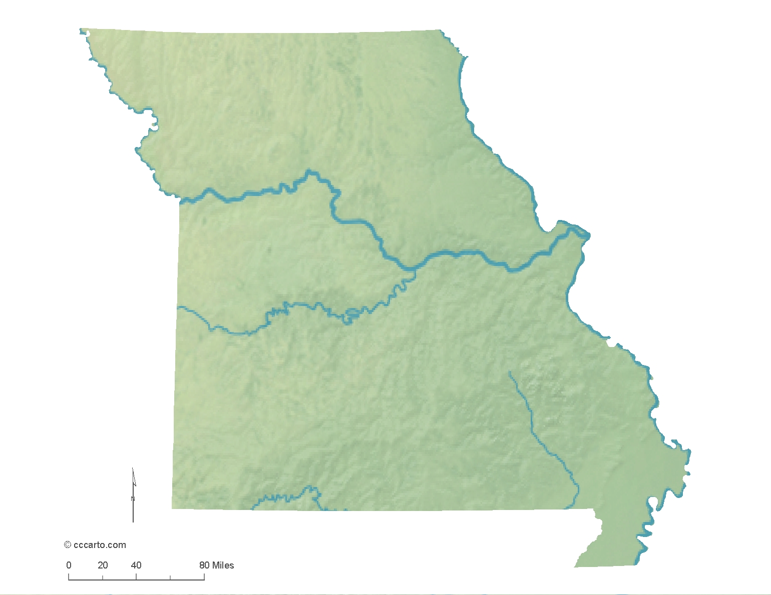
Missouri Topographic State Map | Shaded Relief
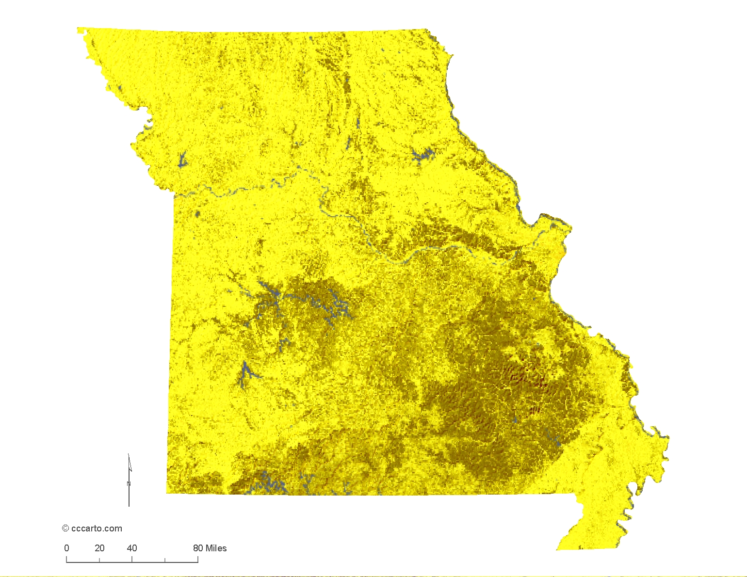
Missouri offers diverse terrains shaped by its unique geological history, from the rolling hills of the Ozarks to the vast plains of the northern region.
1. Ozark Highlands
The Ozark Highlands cover much of southern Missouri and feature rugged hills, bluffs, and caves. This region is known for its natural beauty, with forests, rivers, and the iconic Missouri Ozarks.
2. Central Lowlands
Northern Missouri is part of the Central Lowlands, characterized by flat to gently rolling plains. This area supports extensive agriculture and is known for its fertile soils and vast farmlands.
3. Mississippi Alluvial Plain
The southeastern corner of Missouri, known as the "Bootheel," is part of the Mississippi Alluvial Plain. This low-lying region is shaped by the Mississippi River and is a major agricultural area, particularly for cotton and rice farming.
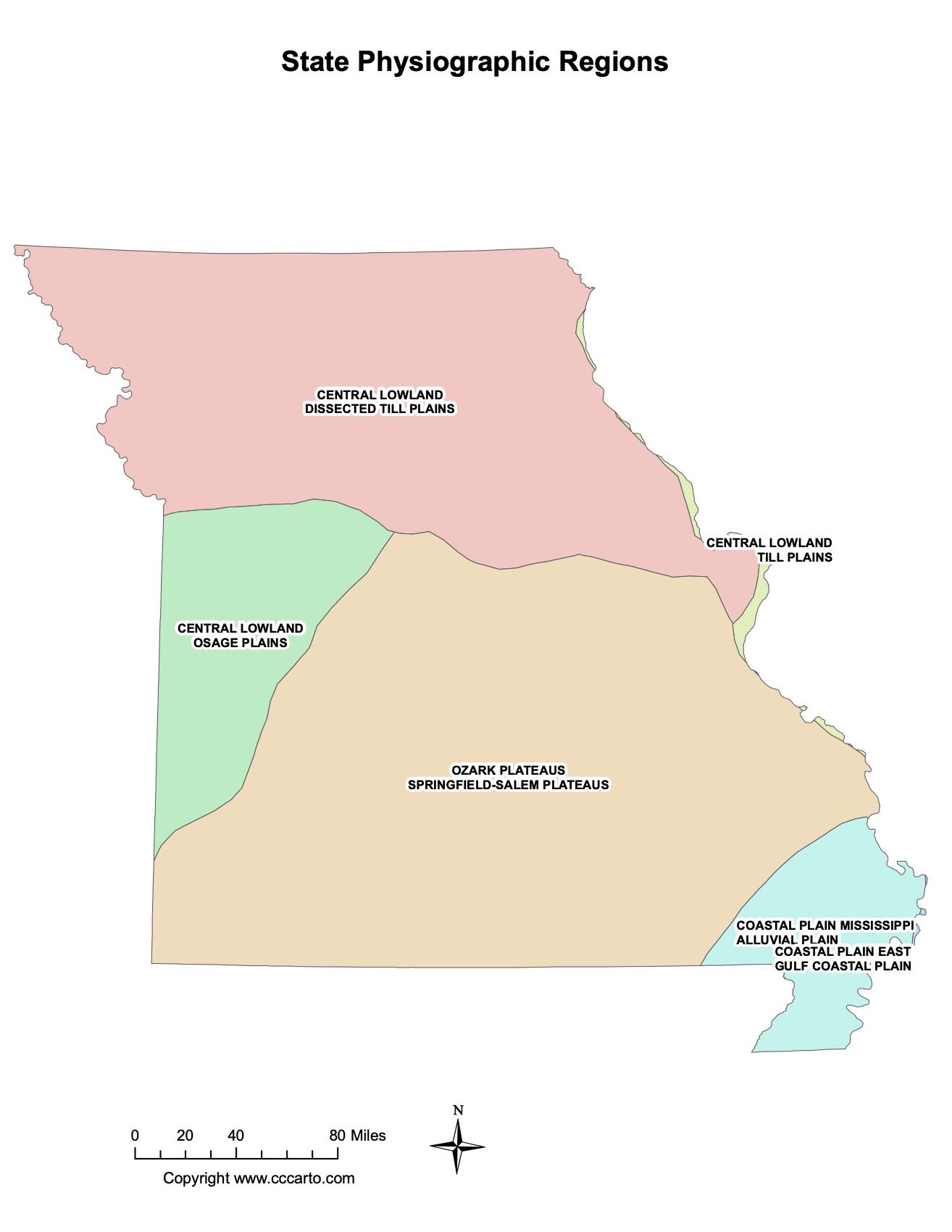
Missouri Physiographic Regions State Map
Central Lowland, Dissected Till Plains
This region in northern Missouri is characterized by glaciated plains with rolling hills and fertile soils. It is a prime area for agriculture.
Ozark Plateaus, Springfield-Salem Plateaus
The Ozarks in southern Missouri feature steep hills, caves, and deep valleys. The Springfield-Salem Plateau is a unique subregion known for its karst topography and rich biodiversity.
Coastal Plain, Mississippi Alluvial Plain
The Bootheel region, part of the Coastal Plain, is a flat, low-lying area shaped by the Mississippi River. It is one of Missouri's major agricultural regions.
Interior Highlands, St. Francois Mountains
This region in southeastern Missouri contains some of the oldest exposed rocks in North America. The St. Francois Mountains are known for their igneous rock formations and scenic views.
Osage Plains
Located in the western part of the state, the Osage Plains are a transition zone between the more rugged Ozarks and the flatter Great Plains. The area is known for its prairies and agricultural production.
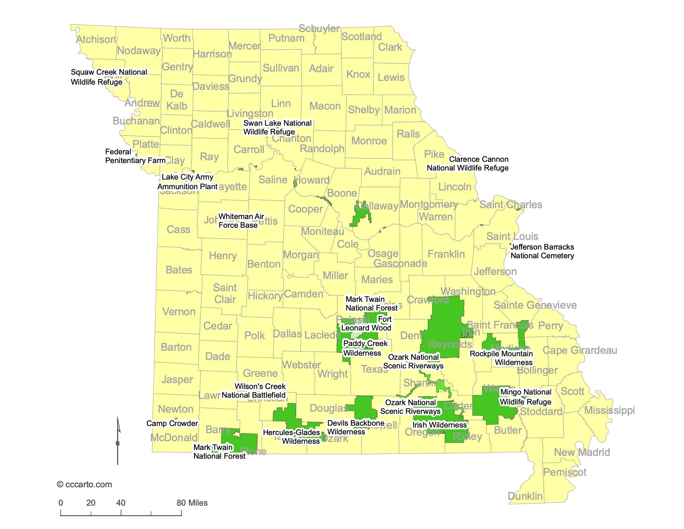
Largest and Most Interesting Federal Lands in Missouri
1. Mark Twain National Forest
Mark Twain National Forest covers a large portion of southern Missouri. It features dense forests, rivers, and the Ozark Trail, offering extensive opportunities for hiking, camping, and wildlife viewing.
2. Ozark National Scenic Riverways
Located in southern Missouri, the Ozark National Scenic Riverways protects the free-flowing Current and Jacks Fork Rivers. This area is known for its clear, spring-fed rivers, karst features, and recreational activities such as canoeing, fishing, and camping.
3. Big Muddy National Fish and Wildlife Refuge
This refuge along the Missouri River protects important wetland habitats and provides a haven for wildlife. It is also a popular spot for birdwatching and hiking.
4. Wilson's Creek National Battlefield
Wilson's Creek National Battlefield commemorates the site of an important Civil War battle in southwest Missouri. Visitors can explore the battlefield, hike trails, and learn about Missouri's Civil War history.
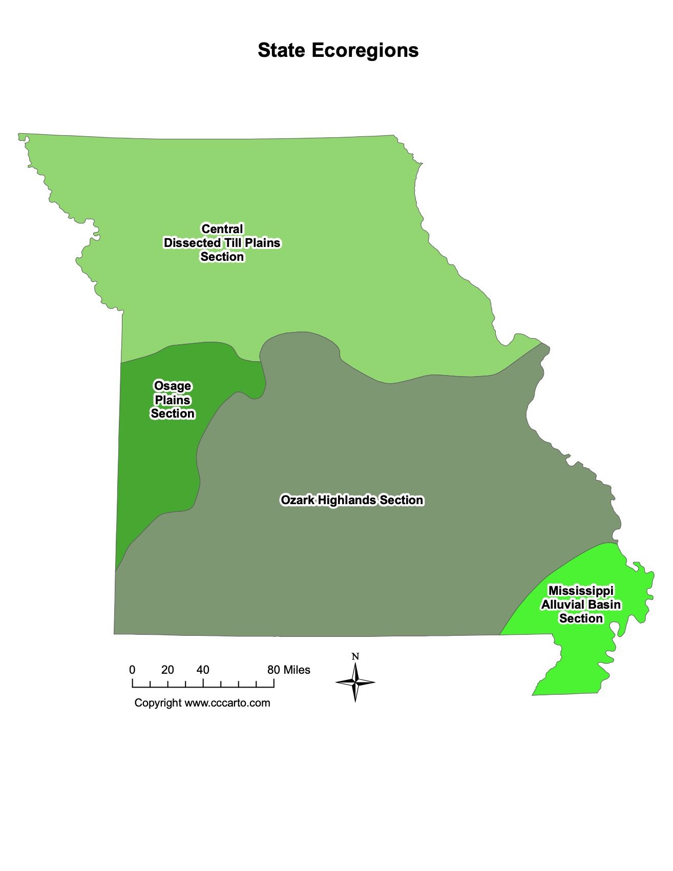
Missouri Ecoregions State Map | EPA Ecological Zones
Central Dissected Till Plains Section
This ecoregion in northern Missouri features rolling hills and fertile plains shaped by glaciation. It supports extensive agriculture, particularly corn and soybeans.
Mississippi Alluvial Basin Section
Located in the southeastern Bootheel, this ecoregion is a low-lying, flat area dominated by agriculture, particularly cotton and rice. The region has been heavily modified by human activity.
Ozark Highlands Section
The Ozark Highlands in southern Missouri are characterized by rugged hills, forests, and karst topography. The region supports a diverse range of wildlife and is known for its scenic beauty.
Osage Plains Section
The Osage Plains in western Missouri are a transition zone between the tallgrass prairies to the west and the more forested Ozarks to the east. The region is known for its rolling hills, grasslands, and agricultural activity.