🗺 Click to explore interactive map
Parkfield California Earthquake Fault Map
View earthquakes for the last 30 days
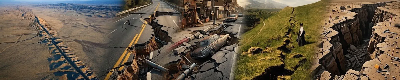
Parkfield, CA, is located along the San Andreas Fault in California, making it a significant area for earthquake research. Here are details regarding your questions:
Parkfield Earthquake Faults:
Parkfield lies directly on the San Andreas Fault, which is the major fault separating the Pacific Plate and the North American Plate. This fault is known for its potential to generate large earthquakes due to the tectonic forces at play.
Frequency of Parkfield Earthquakes:
Parkfield is particularly famous for its regularity in experiencing moderate earthquakes. It gained attention because of its reputation as the "earthquake capital of the world" due to the relatively predictable occurrence of moderate earthquakes.
Importance in Parkfield Earthquake Studies:
Predictable Earthquakes: Parkfield gained importance because it experiences magnitude 6 earthquakes approximately every 22 years on average, making it one of the most predictable earthquake zones globally.
Research Opportunity: Scientists study Parkfield intensively to understand earthquake dynamics, fault behavior, and to improve earthquake forecasting and early warning systems.
Long-term History of Parkfield Earthquakes:
Historically, Parkfield has experienced a series of magnitude 6 earthquakes roughly every two to three decades, although the exact timing can vary.
Location between Los Angeles and San Francisco:
Parkfield's location along the San Andreas Fault, approximately halfway between Los Angeles and San Francisco, is crucial for studying the fault's behavior over a long stretch. It provides a cross-section view of how the fault moves and behaves.
Universities and Government Agencies:
Several universities and government agencies conduct long-term earthquake research in Parkfield, including the United States Geological Survey (USGS) and various academic institutions like Stanford University and the University of California, Berkeley.
Movement of Parkfield:
Parkfield sits on the creeping section of the San Andreas Fault, where the plates move horizontally past each other. The area moves at a rate of several centimeters per year, contributing to the buildup of stress that leads to earthquakes.
Timing of Next Earthquake:
Predicting the exact timing of earthquakes is challenging, but based on historical patterns, Parkfield is considered overdue for a magnitude 6 earthquake. However, this does not mean it will happen precisely on schedule, as earthquake timing can vary widely.
In summary, Parkfield is a critical location for earthquake research due to its location on the San Andreas Fault, its history of predictable earthquakes, and the opportunity it provides for studying fault behavior and earthquake dynamics.
Central California Earthquake Faults
Parkfield Area Faults Map

San Andreas Fault Creeping Section Map

The seismicity of Parkfield, which sits on the San Andreas, is noteworthy for many reasons.
First, since 1857, six similar, magnitude 6 earthquakes have hit on the San Andreas fault near Parkfield with apparent clockwork regularity -- one approximately every 22 years.
Secondly, waveforms recorded on area seismographs are strikingly similar for the 1922, 1934 and 1966 earthquakes, suggesting that these earthquakes involved repeated rupture of the same area on the fault. These observations suggest that there may be some predictability in the occurrence of earthquakes, at least at Parkfield.
Fault Attributes Key
NAME is an 80-character field for the name of the fault (including section name,
i.e., Denali fault, Holitna section). Fault and section are lower case.
CODE is a three-integer field.that defines certainty or reliability of field mapping
(integer one), time of most recent movement (integer two), and amount or rate of slip (integer three).
CODE is composite of the single integer fields ACODE, SLIPCODE, and FCODE
and determines the line type (fault trace) to be plotted.
NUM is a six-character unique USGS identifier that defines a fault or section id. Simple fault
ids are only numeric; section ids are alpha numeric.
AGE is the upper bounding time of the most recent surface-deforming earthquake. The allowable
choices are provided in a pull-down menu.
ACODE is the second integer in CODE and defines the upper bounding time of the most recent
surface-deforming earthquake.
Permissible values are between 1 and 6: 1=historic «150 years; red =cmyk 1096680);
2= post glacial (15,000 years; orange = cmyk 1 38 1000);
3 = late Quaternary «130,000 years; green> cmyk 1002500);
4 =middle and late Quaternary «750,000 years: blue > cmyk 1004440);
5 =Quaternary «1,600,000 years; black 5);
6 = Class B (black halftone)
In the text documentation, Quaternary faults (integer two, 1-5) are Class A structures. Questionable or
suspected structures are Class B (integer two, 6).
SLIPRATE is the assigned slip rate category.
SLIPCODE is the third integer in CODE and defines the assigned slip rate category. Permissible
values are between 1 and 4 and determines line width:
1=>5 mm/year (extra wide; .048):
2 =1-5 mm/year (wide; .0325):
3 =0.2-1 mm/year (medium; .025);
4 =<.2 mm/year (thin; .015)
SLIPSENSE is normal, reverse, strike slip, thrust
DIPDIRECTION is one of the eight quadrant dip directions for the entire fault or section, not the
individual arc. C = center E =east N_ =north NE =northeast NW =northwest S =south SE =southeast SW =
southwest W_ =west
SLIPDIRECT (we are not using that field anymore and can be left empty) FCODE is the first integer
in CODE and defines how well the fault is located and expressed in the landscape. Permissible values are
between 1 and 3:
1 = fault landforms are more continuous than discontinuous and mapping is accurate at
given MAPPEDSCALE (solid);
2 = fault landforms are more discontinuous than continuous and mapping is accurate at
given MAPPEDSCALE (dashed);
3 = location of fault is inferred (dotted)
FTYPE is one of three allowable choices provided in a pull-down menu: Well constrained (FCODE 1),
Moderately constrained (FCODE 2), and Inferred (FCODE 3)
MAPPEDSCALE is one of four allowable choices provided in a pull-down menu.
Mapped scale will control visualization of the fault at various scales.
1:24,000, fault should be more continuous than discontinuous and mapping is accurate at <10,000 scale.
1:50,000, fault should be more continuous than discontinuous and mapping is accurate at <25,000 scale.
1:100,000, fault could be more discontinuous than continuous and mapping is accurate at <50,000 scale.
1:250,000, fault location may be inferred or is poorly constrained.
Click on the fault lines for more information.
Note* The earthquake faults are color coded by unique name and section not type.
Data source: USGS
CCCarto is not responsible for data errors or omissions, use as reference only.
copyright cccarto.com 2026