Lower Rock Creek Mountain Bike Trail
Eastern Sierra • Between Tom’s Place & Round Valley (Paradise)
Classic Eastern Sierra singletrack paralleling Rock Creek through oak, pine, and aspen. Ridden as a shuttle (top → bottom), a loop of the upper two sections, or an out-and-back from the lower trailhead.
7.45 miles one-way (≈ 12.0 km), top to bottom.
Start: 6,891 ft • End: 4,961 ft
Net drop: 1,930 ft (≈ 589 m) • Avg. net grade: ~-4.9%
Expect short, punchy rises along the way.
April–November typical. Lower canyon can be rideable in winter; upper sections hold snow. Fall color: late Sept–late Oct by elevation.
Parking & Shuttle Options
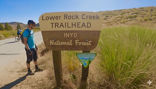
Bottom (Paradise / Round Valley) — Lower Rock Creek Rd, just after crossing the creek in the community of Paradise. Signed lot with picnic tables and a pit toilet. Best place to leave a shuttle car.
Top (near US-395 & Old Sherwin Grade / Lower Rock Creek Rd junction) — Small roadside pullouts/pockets near the junction south of Tom’s Place. Space is limited; do not block gates or private driveways.
Tip: Weekends and peak leaf-peeping days can be busy. Arrive early, consolidate vehicles, and keep noise down near residences.
Trail Sections & Difficulty
| Section | Character | Who it suits | Notes |
|---|---|---|---|
| 1 — Upper | Flowy singletrack through forest with some rock/root gardens, short ups. | Strong beginners to intermediates. | Good place to lap or warm up; shuttlers often start here. |
| 2 — Middle | Classic fast bends, creek proximity, a few tighter turns; brief road crossing at end. | Intermediates. | Stay alert where the trail nears the water; slow for blind corners. |
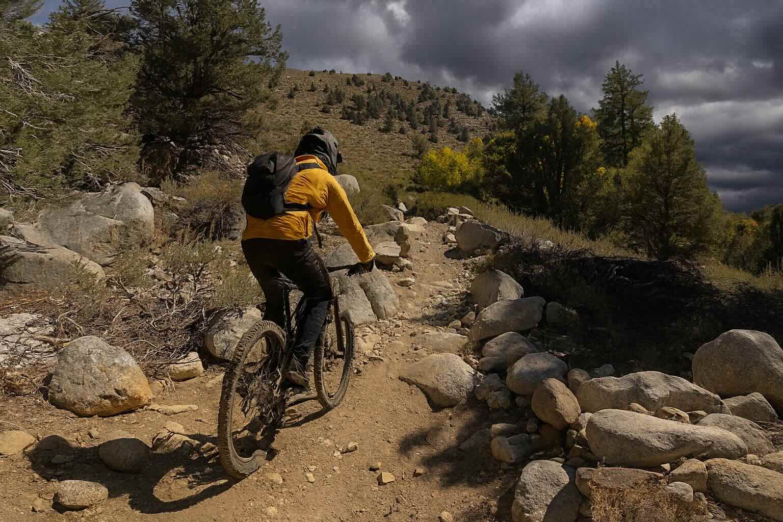
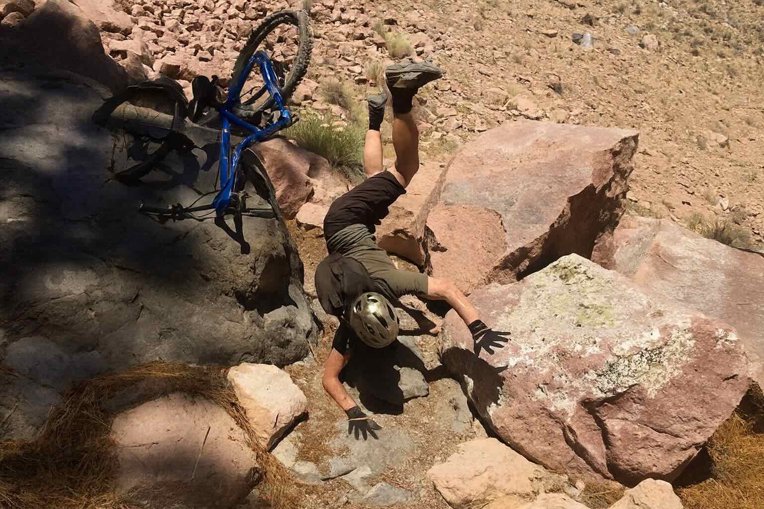
| 3 — Lower “Gorge” | Rockier, narrower, and longer with solidly technical rock gardens and tighter switchbacks. | Upper-intermediate to advanced riders. | High pinch-flat potential; control speed, especially on exposure and loose rock. |
How to Ride It
- Shuttle, Top → Bottom (7.45 mi / 1,930' down)
- Upper Two Sections Loop (~6 mi)
- Out-and-Back from the Bottom (choose your turnaround)
Leave a car at the Paradise (lower) lot, drive up to the upper pullouts, ride all three sections down. Popular, fastest option.
Park near the bottom of Section 2, pedal the paved Lower Rock Creek Rd up, drop the trail back down. Great flow without the lower rocky commitment.
Start at Paradise, climb singletrack as far as you like, then enjoy a sustained downhill back to the car. Climbing effort scales with your turnaround point.
Multi-Use Etiquette — Hikers & Anglers
- Yield to foot and equestrian traffic. Slow well in advance; communicate and pass with courtesy.
- Expect anglers stepping to/from the creek, especially near access spurs—speed check in those zones.
- Two road crossings (after Sections 1 & 2): stop, look, and roll through carefully.
- Run a bell in leaf season; corners can be blind with foliage and granite outcrops.
Bike & Gear Notes
- Tires: robust casings + inserts recommended for the lower gorge’s rock gardens; carry at least one spare tube.
- Pressure: don’t run too soft—pinch-flat city in the rocks.
- Hydration & heat: lower trailhead sits much lower/warmer; start early in summer.
Best Time of Year & Fall Color
Rideable most of the year depending on snow line. The upper sections melt out later; the lower canyon is often snow-free in winter. For prime dirt and temps, target May–June and September–November.
Fall color: Aspens higher up and cottonwoods lower down typically peak from late September into October. The color “drops” with elevation; the Lower Rock Creek Road / Round Valley area often pops mid- to late October in most years.
Regulations & Access
E-bikes (e-MTBs): Lower Rock Creek singletrack is a non-motorized trail on Inyo National Forest land; e-bikes are not permitted on the singletrack. You may ride an e-bike on the public paved road (Lower Rock Creek Rd) unless otherwise posted. Always confirm current orders before you go.
Key Stats (quick read)
| Total distance (top → bottom) | 7.45 miles (≈ 12.0 km) |
|---|---|
| Start / End elevation | 6,891 ft → 4,961 ft |
| Net vertical drop | 1,930 ft (≈ 589 m) • Avg. net grade ~-4.9% |
| Typical season | April–November (lower canyon can be rideable in winter) |
| Best riding windows | Cool mornings in summer; fall for color + hero temps |
| Skill split | Sections 1–2: Intermediate; Section 3: Upper-intermediate to Advanced |
| Shuttle | Park a car at Paradise (Round Valley), start near the 395 / Old Sherwin Grade junction |
| Facilities | Pit toilet + tables at lower (Paradise) lot; limited parking up top |
Always check current conditions, closures, and fire restrictions. Pack out what you pack in.