West Yellowstone, Montana, lies in a seismically active volcanic hot-spot region surrounded by several significant earthquake faults, each with its own characteristics and potential hazards. Here’s a detailed overview of the faults and related seismic activity around West Yellowstone:
Lava Creek Caldera Margin: This area features faults associated with the Yellowstone volcanic system, likely involving normal faults due to the volcanic processes and uplift.
Island Park Caldera Rim faults: These faults are typically associated with the caldera boundary and can include both normal faults and strike-slip faults.
East Gallatin-Reese Creek Fault System: Known for its complex faulting patterns, involving both normal and strike-slip faults.
Post-Lava Creek Faults in NW Yellowstone National Park: These faults are often normal faults due to ongoing volcanic and tectonic activity in the region.
Eagle Bay Fault: Primarily a normal fault, influenced by the broader tectonic setting of the region.
East Mount Sheridan Faults: Likely to be strike-slip faults due to their orientation and structural characteristics.
Snake River Caldera Faults: Associated with the large-scale volcanic activity of the Snake River Plain, these faults can be normal or strike-slip.
Centennial Fault: Generally a strike-slip fault, influenced by regional tectonic forces.
Red Canyon Fault: Primarily a normal fault, related to the tectonic activity of the region.
Sour Creek Dome Faults: These faults can vary but are often normal faults associated with the geologic structure of the Sour Creek dome.
Shoshone Lake Faults: Normal faults due to the volcanic and tectonic processes in Yellowstone.
Hebgen Fault: Famous for the 1959 earthquake, a significant strike-slip fault affecting the region.
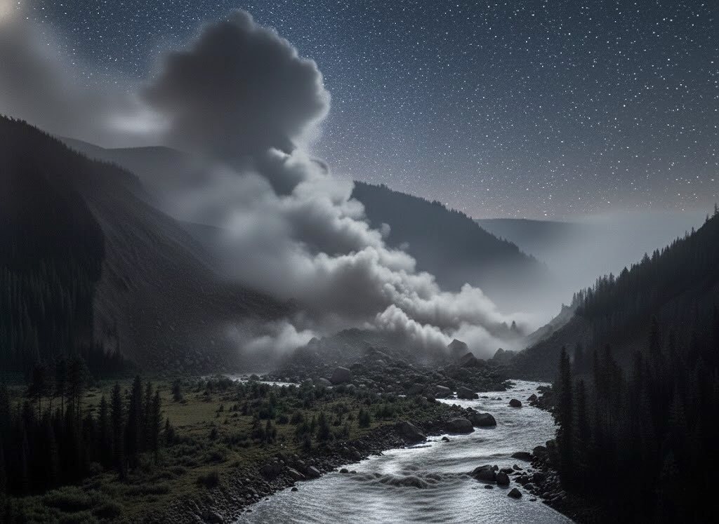
Earthquake (Quake) Lake was created by the August 17, 1959, 11:37 p.m. Hebgen Lake 7.3 earthquake, which ruptured the Hebgen Lake and Red Canyon normal faults (part of the Hebgen fault zone). The quake triggered the Madison Canyon landslide(above) that dammed the Madison River and formed the lake.
2. Most Active Faults:
The Hebgen Fault is historically the most active and significant in terms of seismic activity, known for producing large earthquakes in the past.
3. Earthquake Hazards:
Liquefaction: Areas with loose, water-saturated soils are susceptible to liquefaction during strong shaking.
Landslides: Steep slopes and weak geological formations can trigger landslides.
Building and Structure Collapse: Poorly constructed or older buildings are at risk of collapse.
Fires: Earthquakes can rupture gas lines and electrical systems, leading to fires.
4. Areas Facing Worst Shaking:
Areas close to the Hebgen Fault and other major faults like the Snake River Caldera Faults would experience the strongest shaking due to their proximity to active fault lines.
5. Major Earthquakes in the Last 20,000 Years:
The 1959 Hebgen Lake earthquake is the most notable recent earthquake, with a magnitude of 7.3, affecting the region significantly.
6. Earthquake Lake Formation:
The 1959 Hebgen Lake earthquake created Earthquake Lake. It occurred on August 17, 1959, triggered by the Hebgen Fault slipping. The earthquake measured 7.3 on the Richter scale.
Geological events included a massive landslide that blocked the Madison River, forming Earthquake Lake. Approximately 80 million tons of rock fell into the valley, displacing water and forming the lake.
28 people were killed as a result of the earthquake and subsequent landslide.
The lake filled rapidly, reaching its current depth within a few weeks to months after the quake.
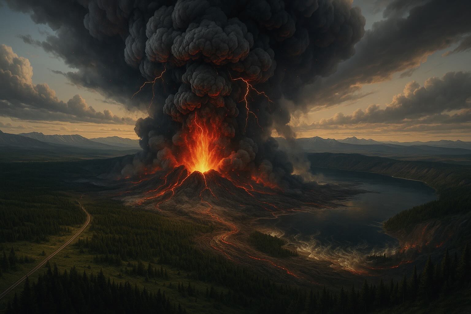
7. What is Yellowstone’s “supervolcano”?
Yellowstone is a large caldera system at the northeastern end of the
Snake River Plain, created by several enormous explosive eruptions over the last
~2.1 million years. The term “supervolcano” refers to rare, very large eruptions that
produce ≥1,000 km³ of material (VEI-8). After each giant eruption, the ground collapsed
to form a broad caldera; later, dozens of rhyolitic lava flows partly refilled the basin.
Short, source-backed timeline
~16 million years ago (Miocene): The Yellowstone hotspot begins affecting the region;
as North America drifts SW over the hotspot, a chain of calderas forms along today’s Snake River Plain.
~2.1 million years ago — Huckleberry Ridge Tuff (VEI 8): >2,450 km³ eruption; a ~75 km-wide caldera forms.
~1.3 million years ago — Mesa Falls Tuff (VEI 7): A smaller, yet still very large caldera-forming eruption.
~631–640 thousand years ago — Lava Creek Tuff (VEI 8): The most recent giant eruption that created the present Yellowstone Caldera (≈45×85 km).
~173 thousand years ago: A sizable explosive event forms the West Thumb caldera within Yellowstone Lake (comparable in scale to Crater Lake’s event).
~77–70 thousand years ago: The most recent lava eruptions—rhyolitic flows like the Pitchstone Plateau—occur inside the caldera (no ash-cloud “supereruption”).
~14–3 thousand years ago (Holocene): Multiple large hydrothermal explosion craters form in and around Yellowstone Lake; Mary Bay’s blast ~13,800 years ago is among the largest known.
How the hotspot & magma system work
Yellowstone sits above a mantle hotspot; as the North American Plate moves, the hotspot track marches NE across Idaho into Wyoming. Beneath Yellowstone, geophysics reveals two main magma bodies: a shallow silicic (rhyolitic) reservoir (≈5–17 km deep, ~90×40 km) that is mostly solid with ~5–15% melt, and a deeper basaltic reservoir (≈20–50 km). New imaging continues to refine how melt is distributed in these reservoirs.
Current activity & monitoring
Yellowstone is one of the world’s best-monitored volcanoes. Ground rises and falls over years to decades, and earthquake swarms are common—usually normal behavior for a caldera system. A rapid uplift episode in 2004–2010 (up to ~7 cm/year) later slowed and shifted to subsidence (~2–3 cm/year since ~2015). As of the latest monthly update (Nov 3, 2025), alert level is NORMAL, color code GREEN.
>50% of Yellowstone quakes occur in swarms; scientists watch for patterns that would differ from background behavior (for example, intense swarms plus rapid uplift and gas changes).
So… when will Yellowstone erupt again?
There is no fixed schedule and Yellowstone is not “overdue.” Volcanoes don’t erupt on a timetable, and “average intervals” (like “every 600–700k years”) are myths. The most probable future events are small hydrothermal explosions or non-explosive lava flows, not a supereruption. The chance of a cataclysmic event in the next few thousand years is considered exceedingly small.
Possible caldera eruption in the distant future
If Yellowstone were gearing up for a large eruption, scientists expect weeks to years of clear precursors—strong earthquake swarms, rapid ground deformation, and other unmistakable signals—well before the event.
At-a-glance facts
Feature
Summary
Magma storage
Shallow rhyolitic body (~5–17 km) mostly solid (≈5–15% melt); deeper basaltic body (~20–50 km). New 2023–2025 studies further map melt distribution.