Santa Cruz Island, situated off the coast of Ventura, California, is the largest island in the Channel Islands National Park archipelago. Its history spans from the native Chumash people to 19th-century ranching. Today, it is a critical site for littoral geomorphology, featuring one of the world's highest concentrations of volcanic sea caves.
The sea caves of Santa Cruz Island are littoral caves carved by wave energy into Miocene-aged volcanic rock. Our current cartographic survey tracks 114 unique cave features. This includes Painted Cave, which measures 1,214 feet in length (370m), making it a globally significant marine feature. For navigators, understanding the entrance dimensions is essential for safe entry during high swell.
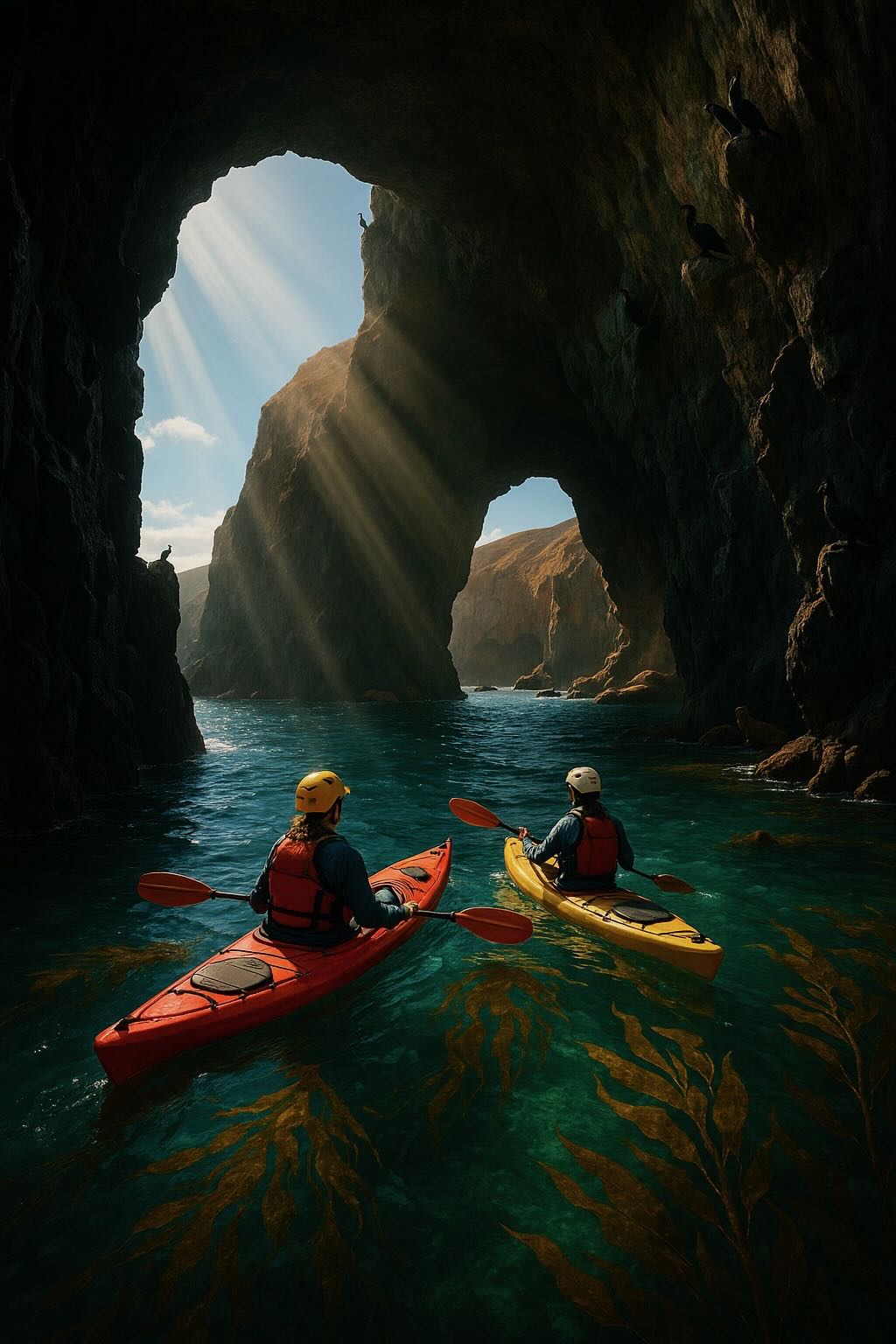
The sea caves are a premier destination for sea kayaking and Channel Islands guided tours. For those departing from Ventura Harbor via Island Packers, Scorpion Anchorage serves as the primary gateway. Because swell conditions can create hazardous surges in narrow tunnels like Deathtrap Cave or Cavern Point, explorers should consult the latest tidal data before entering.
The best time to visit the sea caves is typically during the late spring through early fall when the weather is calm, and the seas are more predictable. Mornings usually offer the most tranquil conditions for exploring the caves. Wind and surf conditions can change rapidly, so always check the weather forecast before planning your trip.
Several companies offer guided kayak tours of the sea caves. These include Channel Islands Adventure Company and Island Packers. Both provide safety equipment and experienced guides to help you navigate the caves. For campers, Santa Cruz Island offers primitive camping at Scorpion Ranch. You can bring your own kayak, but rentals are also available on the island, and they are often a more convenient option for visitors.
Swimming in the sea caves is possible but only recommended for strong swimmers due to strong currents and the chilly Pacific waters. The sea caves are teeming with marine life, including sea urchins, starfish, seals, sea lions, and a variety of fish species. In deeper water, you may encounter kelp forests and even dolphins or whales passing by.
To safely explore the caves, helmets and lights are essential, especially for darker or more enclosed caves. Kayak tours often provide these, but if you’re venturing out independently, ensure you bring the necessary gear. Some caves can be hazardous at high tide, so timing your visit with the tides is crucial.
Most of the sea caves are within the jurisdiction of Channel Islands National Park, meaning they are protected areas. It is essential to follow all park rules and regulations when visiting to preserve the delicate ecosystems within and around the caves.
While there are 114 documented caves, the following are the most significant for navigation and exploration near Scorpion Anchorage and the West End.
| Cave Name | Length (m) | Entrance (W x H) | Survey Notes |
|---|---|---|---|
| Painted Cave | 1,214' (370m) | 30' x 40' | World-class sea cave; massive internal chambers. |
| Neptune's Trident Cave East | 475' (145m) | 34' x 9' | Wet; narrows significantly toward the rear. |
| Sea Stack Cave | 400' (122m) | 6' x 8' | Unique system with multiple wet entrances. |
| Surging T Cave | 354' (108m) | 15' x 11' | High surge zone; complex tunnel system. |
| Coche Cove Cave | 321' (98m) | 11' x 5' | Multi-chambered wet system. |
| Cavern Point Cove Cave #1 | 292' (89m) | 23' x 4' | Wide entrance; predominantly wet. |
| Backdoor Cave | 278' (85m) | 11' x 11' | Significant wet tunnel feature. |
| Scorpion Bay Cave #1 | 252' (77m) | 7' x 8' | Popular wet tunnel near Scorpion Anchorage. |
| Sidepocket Cave | 187' (57m) | 5' x 5' | Frequent stop for guided kayak tours. |
| Lost Lobster Cave #1 | 154' (47m) | 6' x 8' | Wet cave; technical entry. |
Use these official sources to plan a safe trip to Santa Cruz Island and the sea caves of Channel Islands National Park.